The weather forecast for all of iceland for the past week had been strong winds coming from the north, with lots precipitation, some of it snow, some of it rain, but lots of it blowing in sideways. The past few days the weather service had issued landslide warnings in the north of Iceland and closed some mountain roads to the interior.
Thanks to the forecast we had avoided much of that by stalling a bit and staying in the south, where were were sheltered from most of the wind and given warmer temperatures and sunnier skies to boot.
By the weekend this was scheduled to turn a bit into winds from the west, although by Sunday, our last day, it was to be mostly calm and sunny across the nation.
Much as I wanted to stay in the east and wander around the fjords there, and possibly see a reindeer coming down from the highlands to forage, we knew that if we wanted to see godafoss and dettifoss, and explore the baths in Myvatn, and still have time to make it back for our flight Monday, we'd need to pick up the pace.
A trail to Hangandifoss
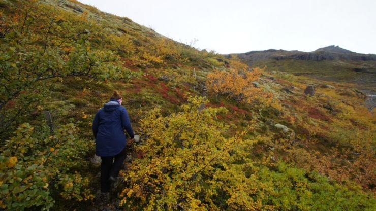
After checking the map again, grabbing the spot tracker, water, drone and camera gear, we set off toward the falls.
It wasn't completely clear where the falls actually were, 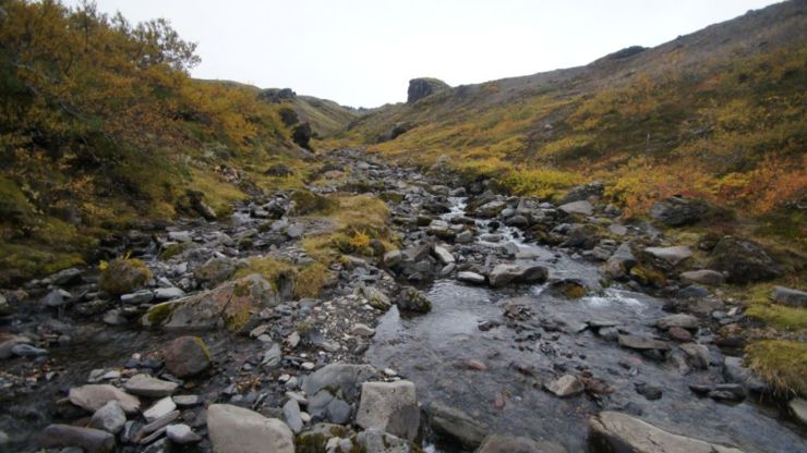
Making our way to the top it was possible to see a few different waterfalls, two separate rivers, and hear the sound of rushing water from multiple directions.
Climbing the hill back up from the valley, we could see a series of hilltops that might either be an end to the trail, or at least concealing the final ascent. With no trees, only the terrain itself really blocks your view of the path. We could see most of the way back down to the parking lot, and probably to our destination too, but it's still far enough away that we can't make it out.
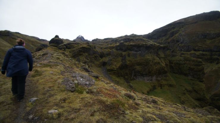
Eventually, we reached the ridge and could see what was obviously quite a tall waterfall, that we had seen in the distance but not really known for sure was the actuall falls we went to see.
Along th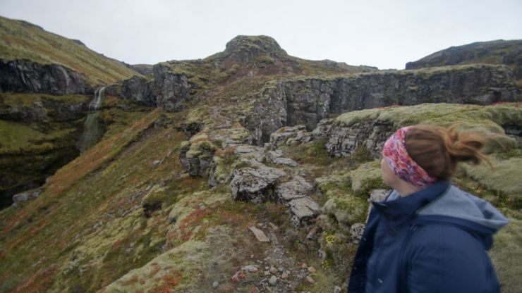
Eventually we reach where the end of the trail is marked on the map, although clearly there is at least a bit more trail over the next hill, and possibly a view of the river for falls beyond responsible for carving out the canyon in the first place. I send the drone to scout ahead.
It turns out that the waterfall up ahead was Mulafoss, named from the Mulagljufur canyon it sits at the head of. The actual falls across the canyon from the endpoint of the trail was Hangandifoss. There is also a third waterfall to the southwest of the canyon that appears to be unnamed.
After seeing the distance to the falls, we decided there wasn't much more payoff for hiking further and decided to do one more trip around with the drone, then descend back down and continue on our way, pressed for time as we were.
Glacier Lake Jokulsarlon
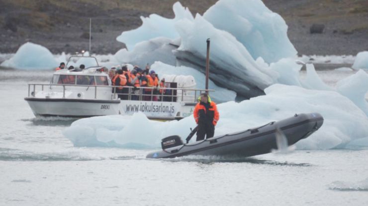
At a nearby restaurant that does tours, they told us that it was too windy today for them to go out on the lake, but other nearby tour operators might still be going out today, and when we went down the the parking lot we saw other groups braving the windy conditions.
There have been incidents involving older WWII era amhibious boats used for tours capsizing in windy conditions, but these newer, only vietnam-era boats were much safer, so there wasn't much concern about the wind.
The tourists also provided some entertainment on top of that, each vying for a unique tourist shot at the lagoon. One woman took quite some time throwing a scarf into the air in different ways to get just the right spontaneous shot.
On a nicer day with a bit more time it'd be tempting to try out the kayak tour and see a bit further into the lagoon beyond just the beach, but for the sake of progress we headed back out toward Hofn.
Stokksnes and the Vestrahorn mountains
Just past Hofn is the Stokksnes site, which has three main draws, primarily the view of the Vestrahorn mountains, and then an unused film set of a replica viking village, and the black sands beach and cliffs area, similar to Vik.
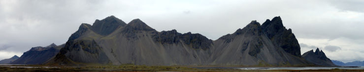
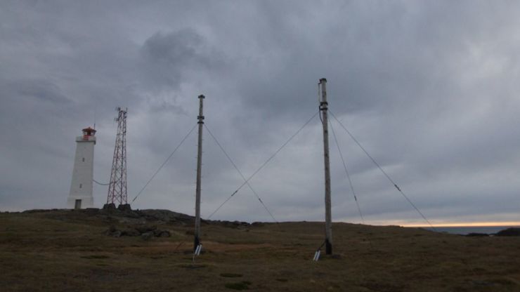
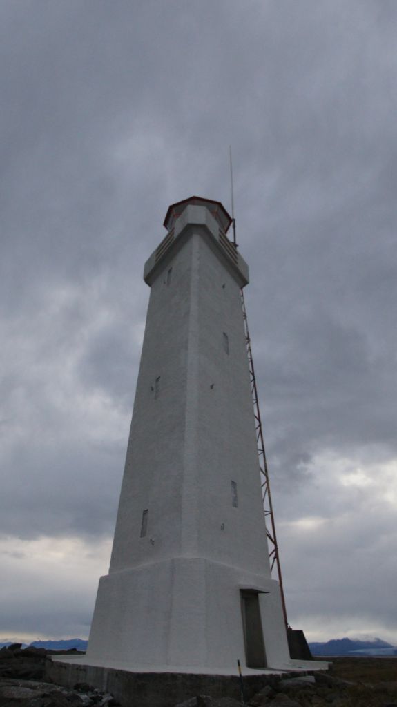
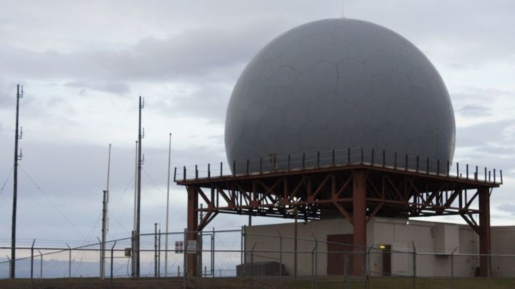
The view is quite striking from out at the point. I took some time to hike back and forth around the penninsula to take a few shots of the mountains themselves, and the lighthouse and old norad base that was present out there.
 |
 |
 |
I took a peek over the hill to see how far the viking village was - it look to be at least a kilomter hike, and was described as built from whatever driftwood and debris they found as they were preparing for the movie that was never actually shot.
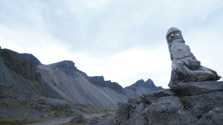
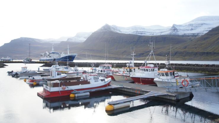
I took a few moments to see the fishermans monument instead, then we headed back toward the north, taking the tunnel through Almannaskarðsgöng and on to the north towards the small fishing villages of the eastern fjords of iceland.
There are no ruins here
We stopped into the small town of Reyðarfjörður to get our bearings and decide on how to proceed towards Myvatn. I really wanted to drive all the way around along the coast and take in more waterfalls, coastal towns and beaches, but we were running out of time.
We drove up and down the streets next to the area, but for all we could see there was only a small playground there - perhaps something was hidden behind the brush, or we had finally found something mislabled among the POIs I had grabbed.
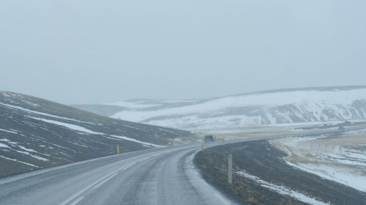
Eventually, we headed north through the highlands instead of around the coastal route, making a straight line for the north of Iceland, headed for Dettifoss, Godafoss and Lake Myvatn.
Myvatn, cows and falls
We arrived in Lake Myvatn around noon. Our first stop was the Myvatn Nature Baths, which has a man made lagoon heated to 50c by the output of a geothermal power plant just down the road. For an hour we took turns cycling between the huge horseshoe shaped pool and the even warmer hot tub near on the deck.
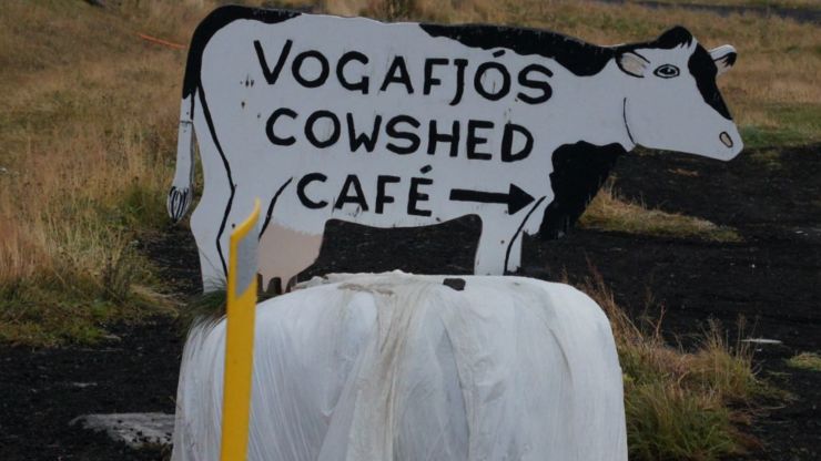
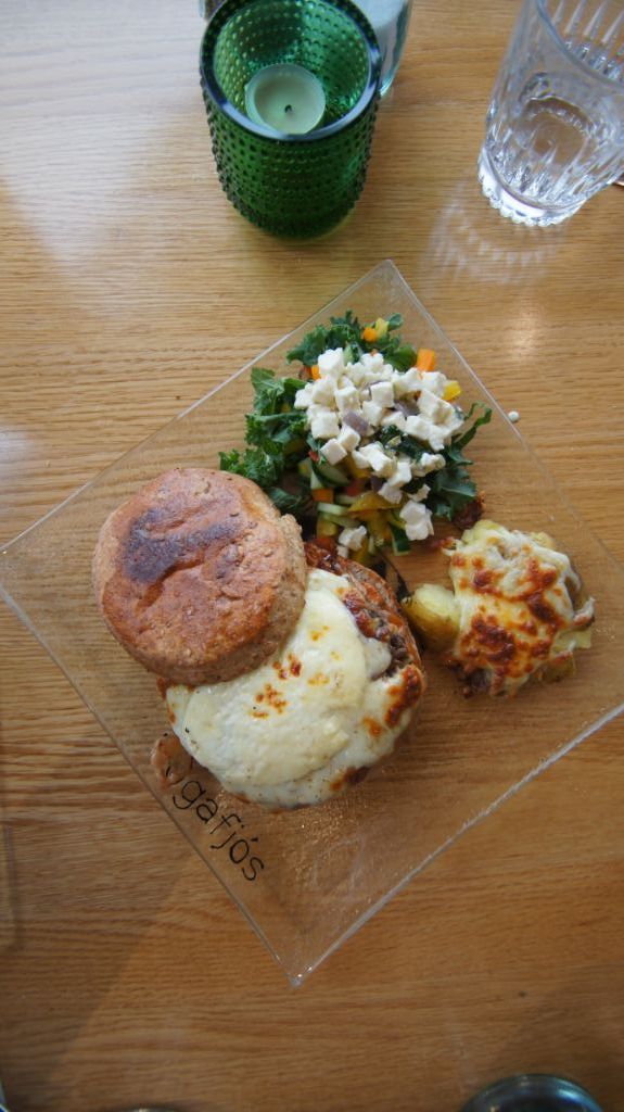
But their claim to fame isn't just local food, but rather that the cowshed is actually attached to the restaurant, with windows from the dining area in to the shed where you can watch the cows graze while you dine.
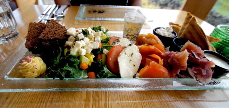
We ordered an appetizer with a bit of everything, including the liqueur they produce, smoked lamb and fish, and the cheese they produce with their dairy operation. For a main course, we went with the cheeseburger.
 |
 |
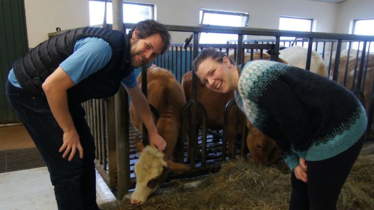 |
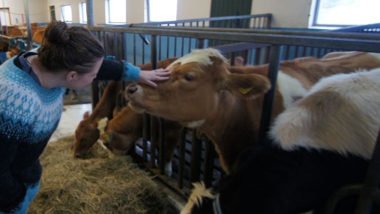
When we finished, we went in to tour the shed, and another tourist came and asked us to take her picture while she petted the cow, offering to do the same in exchange. When she leaned over to pet the cow, the cow took an interest in her sweater and began chewing it. I managed to get at least seven or eight pictures with her camera of the cow consuming her sweater, but it is my singular regret in this life that I have none of my own.
Nearing evening we decided to head back to the east to see Dettifoss, hoping the snow, rain and fog we experienced on the way in to Lake Myvatn had cleared a bit so we could at least see the falls and take some pictures.
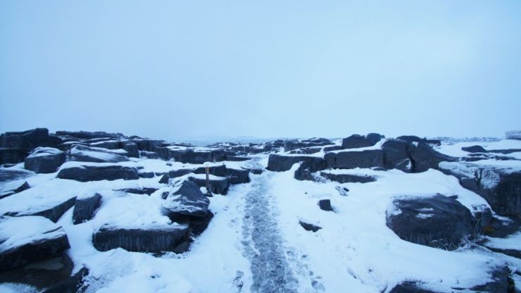
Eventually we found our way to the parking lot. The parking lot was nearly empty. I think the combination of snow on the ground and it nearing dark kept the numbers low, although there were still a few people hanging around trying to get a selfie. Approaching the falls the mist began to blow back onto the path, so the closer you got the more your lens fogged up, so the technique was to position yourself, take a picture, wipe the lens and repeat.
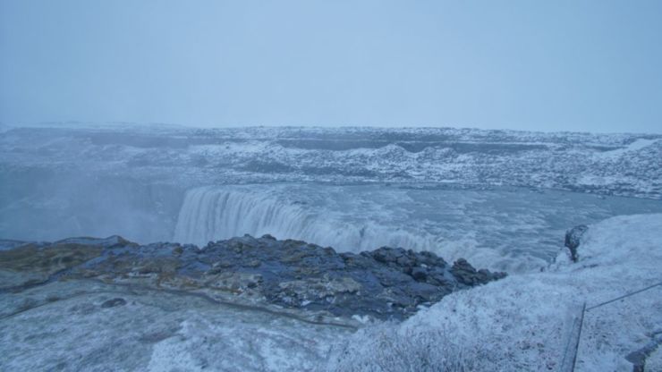
After trying a few longer shots and ending up with big water droplets in the way I started to wonder if the other side of the falls we had tried to approach had a better view or at least less mist.
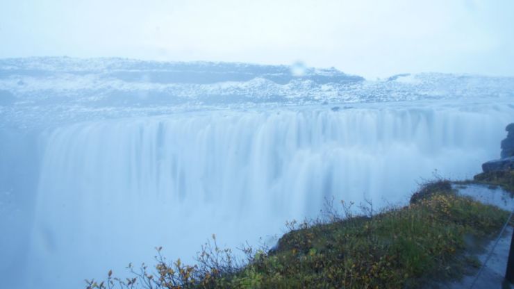
There were two more waterfalls in the area, but required a longer hike to get to, and it was getting dark. We decided to pack it in and begin driving back toward the west again, toward Godafoss.
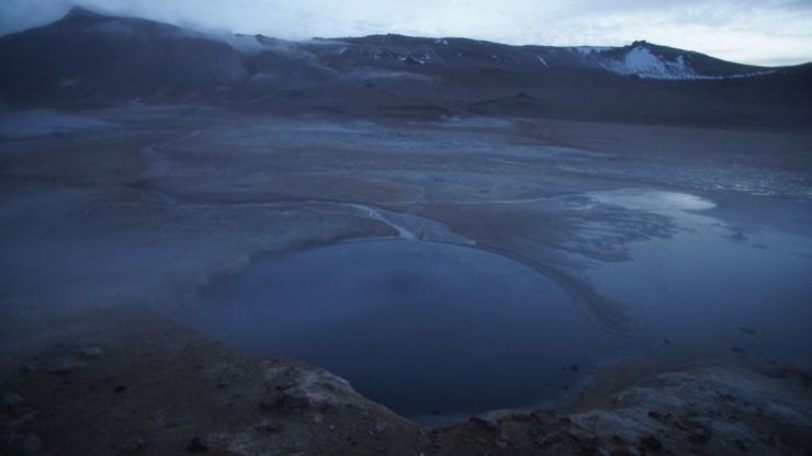
While reading about the Nature Baths area I was a little disappointed to learn that once again the natural hot spring we were visiting wasn't naturally occuring, that the "Nature Baths" were the result of the output of a power plant being redirected to a man made pool. It didn't really occur to me until I came here to Hverir and looked into the pit that the all natural version of the Nature Baths was a boiling pt of mud, hot, slimy with the buildup of salt and sulfur, and not really conducive to a nice soak.
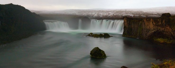
Knowing we were short on time, we chose to head west for the remainder of the evening, rather than camp in the north. We passed through town one last time, but on the way out we made a stop at Godafoss. It was quite late and dark at this point, but the viewing platform had completely cleared out for the day.
I took about an hour, setting up the tripod and taking multiple long exposures to eventually get enough to stitch a panorama. I had to settle a bit on manually focusing in the dark, and there's a fair bit of noise even with the length of the exposures, as with only moonlight there's only so much the sensor can accomplish. There may have been some room for improvement with image stacking, but overall I'm quite happy with the resulting image.
From there we began to head west through the night.